
Enhancing geodata
Interested in strengthening and disseminating thematic data sets that can be reused by different actors or partners and that highlight your professional expertise?
Or are you interested in accessing OpenStreetMap data that has been extracted, transformed, styled, and made available as web feeds or GIS files?
LLg enhances your various geographic data sets through various processing steps after evaluation and according to your needs. These consolidated, supplemented, and transformed data, which can be cross-referenced with other geodata, can also be styled, provided with metadata, and integrated into the IFL, our Infrastructure of Spatial Data (IDS) based on the open-source geOrchestra project. The only limitation is that the data must not contain any sensitive or personal information. In southern territories, LLg seeks to integrate local geographers into these steps so that this enhancement activity also constitutes a component of skill development.
LLg can also extract, transform, and provide access to OSM thematic data under the IFL. This platform allows anyone to freely access the data or restrict access to identified individuals and offer data sets in the form of download points, standard OGC feeds, dynamic maps, dashboards, or geostories.
Geographic data of any kind, provided it is not confidential
- This includes collected data, processed products, thematic layers, as well as specific or multi-thematic OpenStreetMap data for a particular area of interest
- Provided that this data does not contain confidential or personal information
- Redistribution of the data under an open license or via restricted access so that it is shared only among partners
Pre-processing prior to redistribution to enhance the data
- Depending on requirements, the design and implementation of processes to evaluate, compare, consolidate, supplement, and transform datasets
- The ability to cross-reference data with other reference datasets or integrate it into OpenStreetMap, with the owner’s consent
- The creation of map styles for each dataset, designed for use in QGIS or in web maps
A Spatial Data Infrastructure (SDI) for hosting, visualizing, and distributing geographic data
- For organizations that do not yet have a spatial data infrastructure (SDI) or do not wish to build and maintain one, LLg offers to transform and host their data in its Francophone Open SDI (IFL), based on the open-source geOrchestra project
- Data can be made available to the public or restricted to specific audiences via interoperable feeds on any tool using OGC standards
- The IFL allows users to create metadata records, customizable dynamic maps, download links, dashboards, or geostories
A component for local skills development integrated into capacity building
- A systematic effort to involve local OSM groups in these activities in order to train them in this approach and its tools
- The opportunity to train local partners to replicate the steps involved in the promotion process and contribute to their empowerment
- The dissemination, under a free license, of the methodologies, styles, and tools developed as part of the promotion process
Examples of implementations
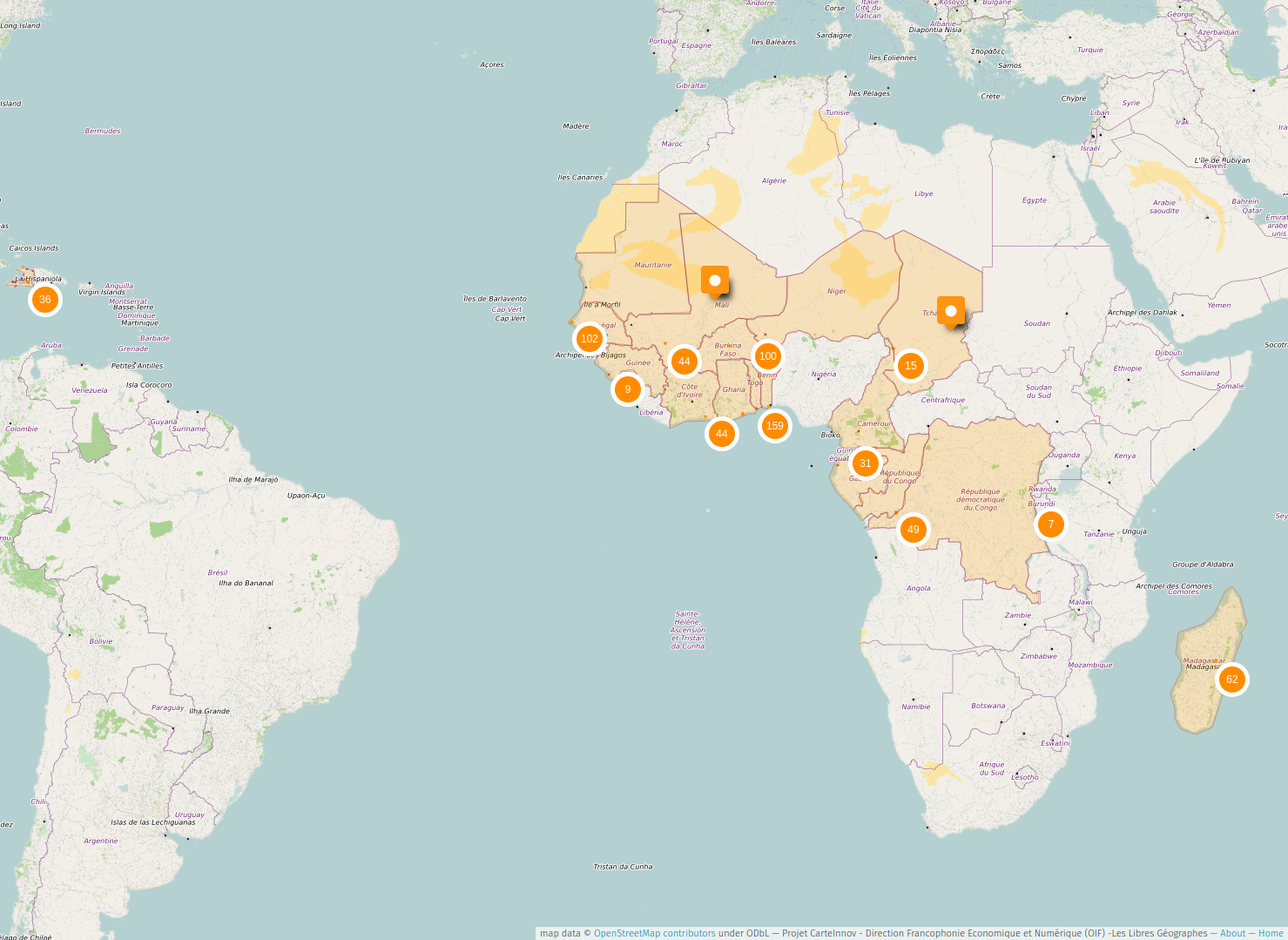
Remote-sensing-based thematic mapping across 20 countries
The data was also accessible and editable in a MapContrib project, which also allowed for the addition and display of logos and photos of the organizations.
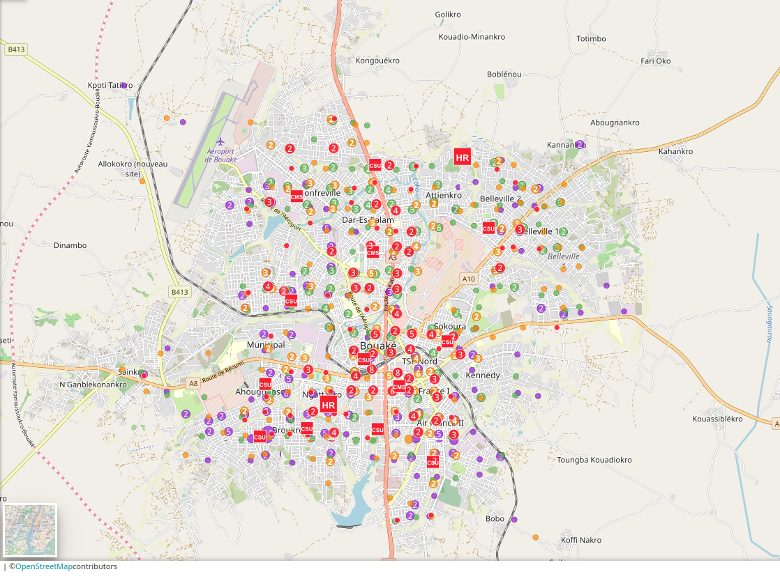
Multi-thematic OSM data for an urban area for research and monitoring purposes
COheSiON, a four-year multidisciplinary project in which LLg organized the mapping of Bouaké, the second-largest city in Côte d’Ivoire, using satellite imagery and field surveys on topics detailed in their attributes using a data model and tools adapted for integration into OpenStreetMap.
Multi-thematic OSM data on urban neighborhoods to conduct a community-based preliminary urban assessment
Sunu Gox, an innovative approach to territorial pre-assessment conducted in partnership with GRET and Y en a Marre (YAM) in working-class neighborhoods of Dakar, Senegal, and carried out with members of grassroots neighborhood organizations affected by the project’s future developments.