Les Libres Geographes
  • Home
  • About us
  • Activities
  • Projects
  • Commons
  • News
  • Partners
  • Contact us
  • Français
  • English
  • Português
Select Page

See full screen

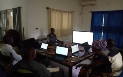
Open-source geomatics support for the National Program for the Control of Human African Trypanosomiasis in Guinea – 2021-2022

Sep 2022 | Field mapping, Free digital mapping and geomatics training, Organisational capacity building, Technical documentation

Following a first capacity-building program implemented in 2019–2020, LLg organized a new program...

CohéSIoN: “Socio-Territorial Constructs of Inequality: Territorial Assessment and Decision Support” in Bouaké – 2022

May 2022 | Commons, Creation and dissemination of free geodata, Field mapping, Free digital mapping and geomatics training, Organisational capacity building, Technical documentation

Context and Approach A multi-partner research project that uses a geographic approach to determine...

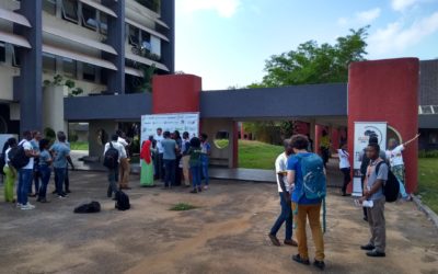
OSM facilitation collective at the international conferences “Understanding Risk (UR) West and Central Africa” and “SotM Africa” in Ivory Coast

Nov 2019 | Conference, Organisational capacity building

As part of its activities in support of open source digital mapping, with the support of two...

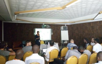
“OpenStreetMap4Transport” (o4t) day at SotM Africa 2019 in Grand Bassam

Nov 2019 | Commons, Conference

The opportunity of SotM Africa to promote the use of OpenStreetMap in the digital field of public...

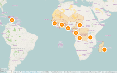
CarteInnov: Mapping Digital Innovation Locations

Oct 2019 | Commons, Creation and dissemination of free geodata, Field mapping, Free digital mapping and geomatics training, Organisational capacity building, Software development, Technical documentation

2016-2019Recognizing the importance of the digital economy as a major driver of development and...

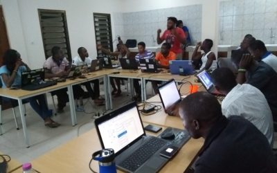
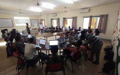
Training workshops on the technical and organizational aspects of implementing OpenStreetMap and open-source geomatics activities in Lomé

Sep 2019 | Free digital mapping and geomatics training, Organisational capacity building

Continuing Capacity Building in Open Geomatics Within a Growing Francophone Sub-Saharan African...

CohéSIoN: “Socio-Territorial Constructions of Inequalities: Territorial Assessment and Decision Support” in Bouaké – 2019

Jul 2019 | Commons, Creation and dissemination of free geodata, Field mapping, Free digital mapping and geomatics training, Organisational capacity building, Technical documentation

July 2019Context and Approach The LLg association, with the support of members of OSM Côte...

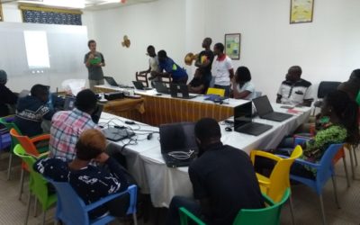
Outreach and Training Workshops on OpenStreetMap and Open Geomatics in Nouakchott

Jun 2019 | Creation and dissemination of free geodata, Free digital mapping and geomatics training

Juin 2019In Mauritania, the OpenStreetMap project was still in its early stages at the time. A...

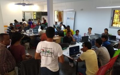
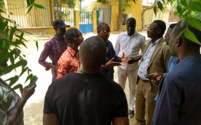
Outreach and Training Workshops on OpenStreetMap and Open Geomatics in Antananarivo

May 2019 | Creation and dissemination of free geodata, Free digital mapping and geomatics training, Organisational capacity building

April 2019Madagascar was included in the CarteInnov project starting in 2017, and...

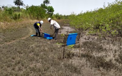
Free Geomatics support for the National Program to Combat Human African Trypanosomiasis in Guinea – 2019-2020

May 2019 | Field mapping, Free digital mapping and geomatics training, Organisational capacity building, Technical documentation

Building on years of volunteer and economic collaborations in Burkina Faso (since 2014), Côte...

« Older Entries

Search

Topics

Commons Conference Creation and dissemination of free geodata Field mapping Free digital mapping and geomatics training Organisational capacity building Software development Technical documentation

Keywords

ANR assessment Benin Bouaké Burkina Faso CEMV Clark University CNF CoheSIoN community empowerment CRD education field mapping Francophonie geOrchestra GIS Guinea IFL InaSAFE inequalities Institut Pierre Richet Institut pour le Développement IPR IRD Ivory Coast KoBoToolbox Les Libres Géographes LLg Lomé lowlands Madagascar Niger ODK OIF OIF-DFEN open data OpenStreetMap OSM QGIS RBM Result-based Management SDI Senegal Togo workshop

Les Libres Géographes


28 rue Hoche
56000 Vannes

— Contact us

  • Mastodon
  • Legal notice

    • Legal Notice
    • Privacy Policy and GDPR
    Site développé par Roxane LE BRETON alias Samloorie
    Gérer le consentement aux cookies
    Pour offrir les meilleures expériences, nous utilisons des technologies telles que les cookies pour stocker et/ou accéder aux informations des appareils. Le fait de consentir à ces technologies nous permettra de traiter des données telles que le comportement de navigation ou les ID uniques sur ce site. Le fait de ne pas consentir ou de retirer son consentement peut avoir un effet négatif sur certaines caractéristiques et fonctions.
    Fonctionnel Always active
    Le stockage ou l’accès technique est strictement nécessaire dans la finalité d’intérêt légitime de permettre l’utilisation d’un service spécifique explicitement demandé par l’abonné ou l’utilisateur, ou dans le seul but d’effectuer la transmission d’une communication sur un réseau de communications électroniques.
    Préférences
    Le stockage ou l’accès technique est nécessaire dans la finalité d’intérêt légitime de stocker des préférences qui ne sont pas demandées par l’abonné ou l’utilisateur.
    Statistiques
    Le stockage ou l’accès technique qui est utilisé exclusivement à des fins statistiques. Le stockage ou l’accès technique qui est utilisé exclusivement dans des finalités statistiques anonymes. En l’absence d’une assignation à comparaître, d’une conformité volontaire de la part de votre fournisseur d’accès à internet ou d’enregistrements supplémentaires provenant d’une tierce partie, les informations stockées ou extraites à cette seule fin ne peuvent généralement pas être utilisées pour vous identifier.
    Marketing
    Le stockage ou l’accès technique est nécessaire pour créer des profils d’utilisateurs afin d’envoyer des publicités, ou pour suivre l’utilisateur sur un site web ou sur plusieurs sites web ayant des finalités marketing similaires.
    • Manage options
    • Manage services
    • Manage {vendor_count} vendors
    • Read more about these purposes
    Voir les préférences
    • {title}
    • {title}
    • {title}